
Here’s the lastest snip of the hurricane as seen on enhanced radar. The eye is quite large and the eyewall has maintained its ragged appearance since yesterday. The central pressure is up to 964 mb and the sustained winds are down a bit. The eye will past well east of our island but I’m afraid that we’ll catch the outer squalls from the storm… soon.
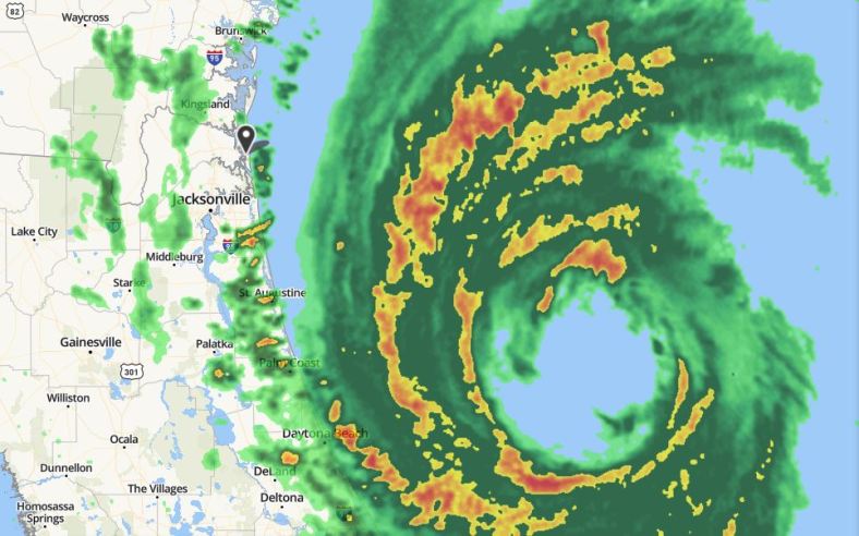
Radar view as of 9 AM this morning. The western edge of the strongest convection and winds are now just about 30 or so miles east of Amelia Island. It’s going to be a close brush with the squalls associated with the outer edge of the storm (the yellow and red areas).
I thought I would post a bit earlier today since there’s a real possibility that we may lose power within the next couple of hours. The last time we lost power was for 61 hours with the passage of Hurricane Irma well west of us in 2017. Hopefully nothing like that this time.
You can see my post from yesterday here.
Chris
